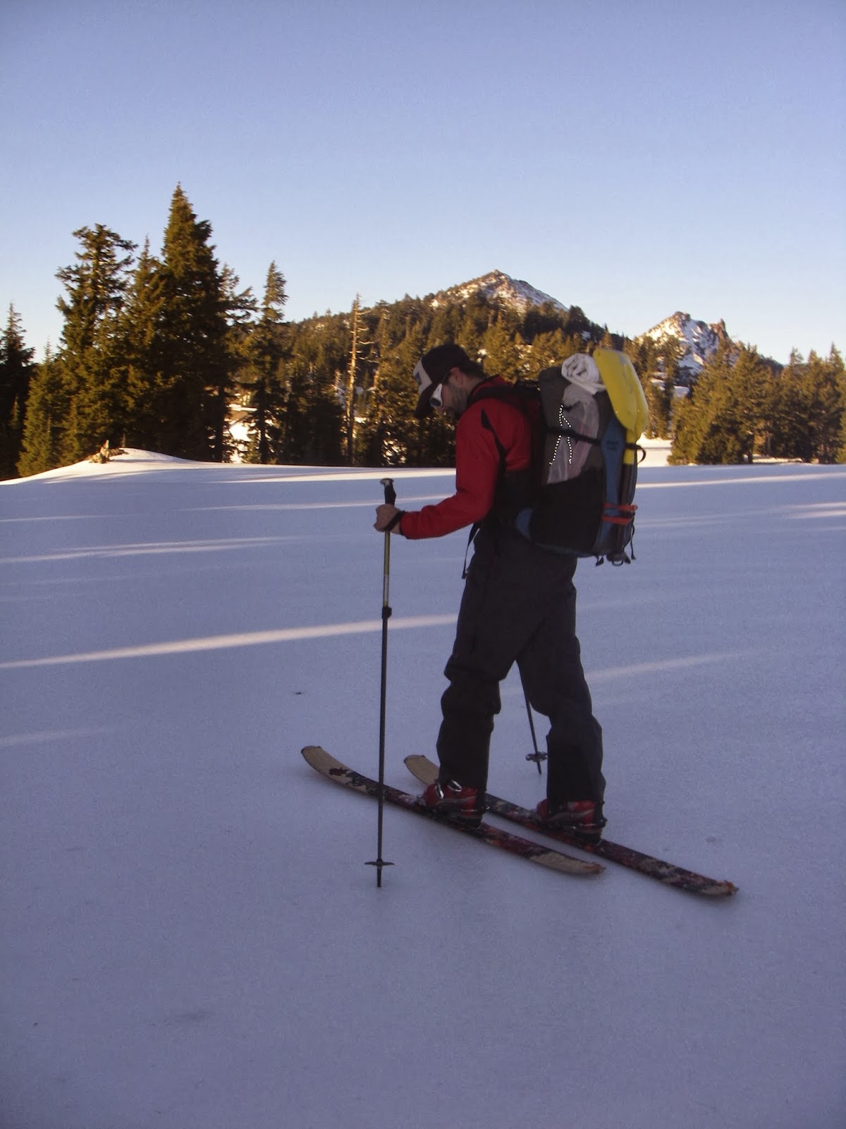
The Oregon Desert Trail (ODT) is a 800 mile hiking route that starts near Bend and ends at Lake Owyhee State Park, near the Snake River in Idaho.
Here is an excerpt from my journal during that visit:
We were attempting to meet Sage on the Oregon Desert Trail with gifts of fruit, cold beer and some good company. A strong wind and bright moonlight led to a restless night's sleep, but when Sage walked up at 6:30 the next morning we sprang up ready to hear about her adventure.
Apparently Oregon Canyon had been a bushwhack fest and her legs were red from hundreds of scratches; the brush was not forgiving. After some hot coffee and berries, we donned packs for the 12ish mile hike to Highway 95 where Kirk would meet us and take us into McDermitt for some relief from the sun.
The day was scorching, but I was excited to hike. Even though we just met a few years ago, Sage and I share many through-hiking experiences. Tales of our different Appalachian Trail, Pacific Crest Trail and other hiking adventures helped the hot miles pass. We talked of the future of the ODT and the roll we have to play, and when we left the easy hiking of the two-track road for the cross-country miles, we played dodge the sagebrush and hop the fence.
Close to the highway we came upon a cool and clear cow tank and couldn't resist splashing around to escape the 100-plus-degree day. Water was plentiful in this flat walk, thanks to the ranchers and their numerous cow tanks. While it could be scummy with green algae or seeping into the ground in a muddy pool, we both were grateful for the appearance of water. We had both been on desert hikes before, on my Arizona Trail hike I often had to drink from muddy water full of cow pies, but that was infinitely preferable to no water. Sage had experienced all sorts of water sources on her Continental Divide Trail and Grand Enchantment Trail; any water is good water!

Kirk met us at the road and we sped to the Oregon/Nevada border town of McDermitt. Lunch was in the dark Say When Casino & Cafe on the Nevada side, and after she retrieved her food drop box and gift of cookies from Adam's mom, we drove to Anderson Crossing.
At Anderson Crossing (two day's walk from where the ODT meets Hwy 95) we planned to leave a food cache for Sage, and tonight would camp on the banks of the West Little Owyhee River. The crossing marks a 180-degree shift in trailtread, as from this point to the end of the trail Sage will be walking in the river canyon or along the rim of the dramatic geological wonder.
It was SO HOT, so we plopped camp chairs in the water and popped open a few beers. Little brook trout were plentiful and beaver activity had dammed up the river right above where we sat soaking our feet.
Kirk and I are packrafters and even though the waterway was narrow and choked with willows at places, decided a pack-rafting alternate would be a great addition to this section of the ODT.
In the morning the sun brought the heat back in full-force. Sage arranged and rearranged her gear; as she wasn't sure how efficient her travel would be though the canyon, she was packing extra food and decided to borrow Kirk's larger Granite Gear Vapor Trail pack (a favorite among many through-hikers for its light weight -- 2 lbs 5 oz -- and large capacity -- 59 liters or 3,600 cubic inches).
We dug a hole in the ground and buried her food, pilling it high with rocks to deter any animals.

We returned to McDermitt, where Sage checked into the motel for a true 0 day (no hiking) to rest her feet and prepare for the next section. After milkshakes and double-bacon cheeseburgers, we said our goodbyes and headed back to Bend.
As
we drove down the two-track dirt road towards Schoolhouse Spring near
the base of Oregon Canyon, the headlights bounced off curious jack
rabbits and hopping field mice. Dusk brought little relief from the
heat, and as we rolled up to our stopping place for the night, cows ran
in all directions to escape the path of the vehicle.
We were attempting to meet Sage on the Oregon Desert Trail with gifts of fruit, cold beer and some good company. A strong wind and bright moonlight led to a restless night's sleep, but when Sage walked up at 6:30 the next morning we sprang up ready to hear about her adventure.
Apparently Oregon Canyon had been a bushwhack fest and her legs were red from hundreds of scratches; the brush was not forgiving. After some hot coffee and berries, we donned packs for the 12ish mile hike to Highway 95 where Kirk would meet us and take us into McDermitt for some relief from the sun.
The day was scorching, but I was excited to hike. Even though we just met a few years ago, Sage and I share many through-hiking experiences. Tales of our different Appalachian Trail, Pacific Crest Trail and other hiking adventures helped the hot miles pass. We talked of the future of the ODT and the roll we have to play, and when we left the easy hiking of the two-track road for the cross-country miles, we played dodge the sagebrush and hop the fence.
Close to the highway we came upon a cool and clear cow tank and couldn't resist splashing around to escape the 100-plus-degree day. Water was plentiful in this flat walk, thanks to the ranchers and their numerous cow tanks. While it could be scummy with green algae or seeping into the ground in a muddy pool, we both were grateful for the appearance of water. We had both been on desert hikes before, on my Arizona Trail hike I often had to drink from muddy water full of cow pies, but that was infinitely preferable to no water. Sage had experienced all sorts of water sources on her Continental Divide Trail and Grand Enchantment Trail; any water is good water!
Kirk met us at the road and we sped to the Oregon/Nevada border town of McDermitt. Lunch was in the dark Say When Casino & Cafe on the Nevada side, and after she retrieved her food drop box and gift of cookies from Adam's mom, we drove to Anderson Crossing.
At Anderson Crossing (two day's walk from where the ODT meets Hwy 95) we planned to leave a food cache for Sage, and tonight would camp on the banks of the West Little Owyhee River. The crossing marks a 180-degree shift in trailtread, as from this point to the end of the trail Sage will be walking in the river canyon or along the rim of the dramatic geological wonder.
It was SO HOT, so we plopped camp chairs in the water and popped open a few beers. Little brook trout were plentiful and beaver activity had dammed up the river right above where we sat soaking our feet.
Kirk and I are packrafters and even though the waterway was narrow and choked with willows at places, decided a pack-rafting alternate would be a great addition to this section of the ODT.
In the morning the sun brought the heat back in full-force. Sage arranged and rearranged her gear; as she wasn't sure how efficient her travel would be though the canyon, she was packing extra food and decided to borrow Kirk's larger Granite Gear Vapor Trail pack (a favorite among many through-hikers for its light weight -- 2 lbs 5 oz -- and large capacity -- 59 liters or 3,600 cubic inches).
We dug a hole in the ground and buried her food, pilling it high with rocks to deter any animals.
We returned to McDermitt, where Sage checked into the motel for a true 0 day (no hiking) to rest her feet and prepare for the next section. After milkshakes and double-bacon cheeseburgers, we said our goodbyes and headed back to Bend.
It was great to be able to meet her in the midst of the hike and set her up for the next section. I'm excited to see the results of Sage's hike for when I tackle a through-hike of the ODT in a few years
- See more at: http://onda.org/where-we-work/oregon-desert-trail/blog/on-to-mcdermitt#sthash.U7RYtXVc.dpuf
We were attempting to meet Sage on the Oregon Desert Trail with gifts of fruit, cold beer and some good company. A strong wind and bright moonlight led to a restless night's sleep, but when Sage walked up at 6:30 the next morning we sprang up ready to hear about her adventure.
Apparently Oregon Canyon had been a bushwhack fest and her legs were red from hundreds of scratches; the brush was not forgiving. After some hot coffee and berries, we donned packs for the 12ish mile hike to Highway 95 where Kirk would meet us and take us into McDermitt for some relief from the sun.
The day was scorching, but I was excited to hike. Even though we just met a few years ago, Sage and I share many through-hiking experiences. Tales of our different Appalachian Trail, Pacific Crest Trail and other hiking adventures helped the hot miles pass. We talked of the future of the ODT and the roll we have to play, and when we left the easy hiking of the two-track road for the cross-country miles, we played dodge the sagebrush and hop the fence.
Close to the highway we came upon a cool and clear cow tank and couldn't resist splashing around to escape the 100-plus-degree day. Water was plentiful in this flat walk, thanks to the ranchers and their numerous cow tanks. While it could be scummy with green algae or seeping into the ground in a muddy pool, we both were grateful for the appearance of water. We had both been on desert hikes before, on my Arizona Trail hike I often had to drink from muddy water full of cow pies, but that was infinitely preferable to no water. Sage had experienced all sorts of water sources on her Continental Divide Trail and Grand Enchantment Trail; any water is good water!
Kirk met us at the road and we sped to the Oregon/Nevada border town of McDermitt. Lunch was in the dark Say When Casino & Cafe on the Nevada side, and after she retrieved her food drop box and gift of cookies from Adam's mom, we drove to Anderson Crossing.
At Anderson Crossing (two day's walk from where the ODT meets Hwy 95) we planned to leave a food cache for Sage, and tonight would camp on the banks of the West Little Owyhee River. The crossing marks a 180-degree shift in trailtread, as from this point to the end of the trail Sage will be walking in the river canyon or along the rim of the dramatic geological wonder.
It was SO HOT, so we plopped camp chairs in the water and popped open a few beers. Little brook trout were plentiful and beaver activity had dammed up the river right above where we sat soaking our feet.
Kirk and I are packrafters and even though the waterway was narrow and choked with willows at places, decided a pack-rafting alternate would be a great addition to this section of the ODT.
In the morning the sun brought the heat back in full-force. Sage arranged and rearranged her gear; as she wasn't sure how efficient her travel would be though the canyon, she was packing extra food and decided to borrow Kirk's larger Granite Gear Vapor Trail pack (a favorite among many through-hikers for its light weight -- 2 lbs 5 oz -- and large capacity -- 59 liters or 3,600 cubic inches).
We dug a hole in the ground and buried her food, pilling it high with rocks to deter any animals.
We returned to McDermitt, where Sage checked into the motel for a true 0 day (no hiking) to rest her feet and prepare for the next section. After milkshakes and double-bacon cheeseburgers, we said our goodbyes and headed back to Bend.
It was great to be able to meet her in the midst of the hike and set her up for the next section. I'm excited to see the results of Sage's hike for when I tackle a through-hike of the ODT in a few years
- See more at: http://onda.org/where-we-work/oregon-desert-trail/blog/on-to-mcdermitt#sthash.U7RYtXVc.dpuf
As
we drove down the two-track dirt road towards Schoolhouse Spring near
the base of Oregon Canyon, the headlights bounced off curious jack
rabbits and hopping field mice. Dusk brought little relief from the
heat, and as we rolled up to our stopping place for the night, cows ran
in all directions to escape the path of the vehicle.
We were attempting to meet Sage on the Oregon Desert Trail with gifts of fruit, cold beer and some good company. A strong wind and bright moonlight led to a restless night's sleep, but when Sage walked up at 6:30 the next morning we sprang up ready to hear about her adventure.
Apparently Oregon Canyon had been a bushwhack fest and her legs were red from hundreds of scratches; the brush was not forgiving. After some hot coffee and berries, we donned packs for the 12ish mile hike to Highway 95 where Kirk would meet us and take us into McDermitt for some relief from the sun.
The day was scorching, but I was excited to hike. Even though we just met a few years ago, Sage and I share many through-hiking experiences. Tales of our different Appalachian Trail, Pacific Crest Trail and other hiking adventures helped the hot miles pass. We talked of the future of the ODT and the roll we have to play, and when we left the easy hiking of the two-track road for the cross-country miles, we played dodge the sagebrush and hop the fence.
Close to the highway we came upon a cool and clear cow tank and couldn't resist splashing around to escape the 100-plus-degree day. Water was plentiful in this flat walk, thanks to the ranchers and their numerous cow tanks. While it could be scummy with green algae or seeping into the ground in a muddy pool, we both were grateful for the appearance of water. We had both been on desert hikes before, on my Arizona Trail hike I often had to drink from muddy water full of cow pies, but that was infinitely preferable to no water. Sage had experienced all sorts of water sources on her Continental Divide Trail and Grand Enchantment Trail; any water is good water!
Kirk met us at the road and we sped to the Oregon/Nevada border town of McDermitt. Lunch was in the dark Say When Casino & Cafe on the Nevada side, and after she retrieved her food drop box and gift of cookies from Adam's mom, we drove to Anderson Crossing.
At Anderson Crossing (two day's walk from where the ODT meets Hwy 95) we planned to leave a food cache for Sage, and tonight would camp on the banks of the West Little Owyhee River. The crossing marks a 180-degree shift in trailtread, as from this point to the end of the trail Sage will be walking in the river canyon or along the rim of the dramatic geological wonder.
It was SO HOT, so we plopped camp chairs in the water and popped open a few beers. Little brook trout were plentiful and beaver activity had dammed up the river right above where we sat soaking our feet.
Kirk and I are packrafters and even though the waterway was narrow and choked with willows at places, decided a pack-rafting alternate would be a great addition to this section of the ODT.
In the morning the sun brought the heat back in full-force. Sage arranged and rearranged her gear; as she wasn't sure how efficient her travel would be though the canyon, she was packing extra food and decided to borrow Kirk's larger Granite Gear Vapor Trail pack (a favorite among many through-hikers for its light weight -- 2 lbs 5 oz -- and large capacity -- 59 liters or 3,600 cubic inches).
We dug a hole in the ground and buried her food, pilling it high with rocks to deter any animals.
We returned to McDermitt, where Sage checked into the motel for a true 0 day (no hiking) to rest her feet and prepare for the next section. After milkshakes and double-bacon cheeseburgers, we said our goodbyes and headed back to Bend.
It was great to be able to meet her in the midst of the hike and set her up for the next section. I'm excited to see the results of Sage's hike for when I tackle a through-hike of the ODT in a few years
- See more at: http://onda.org/where-we-work/oregon-desert-trail/blog/on-to-mcdermitt#sthash.U7RYtXVc.dpuf
We were attempting to meet Sage on the Oregon Desert Trail with gifts of fruit, cold beer and some good company. A strong wind and bright moonlight led to a restless night's sleep, but when Sage walked up at 6:30 the next morning we sprang up ready to hear about her adventure.
Apparently Oregon Canyon had been a bushwhack fest and her legs were red from hundreds of scratches; the brush was not forgiving. After some hot coffee and berries, we donned packs for the 12ish mile hike to Highway 95 where Kirk would meet us and take us into McDermitt for some relief from the sun.
The day was scorching, but I was excited to hike. Even though we just met a few years ago, Sage and I share many through-hiking experiences. Tales of our different Appalachian Trail, Pacific Crest Trail and other hiking adventures helped the hot miles pass. We talked of the future of the ODT and the roll we have to play, and when we left the easy hiking of the two-track road for the cross-country miles, we played dodge the sagebrush and hop the fence.
Close to the highway we came upon a cool and clear cow tank and couldn't resist splashing around to escape the 100-plus-degree day. Water was plentiful in this flat walk, thanks to the ranchers and their numerous cow tanks. While it could be scummy with green algae or seeping into the ground in a muddy pool, we both were grateful for the appearance of water. We had both been on desert hikes before, on my Arizona Trail hike I often had to drink from muddy water full of cow pies, but that was infinitely preferable to no water. Sage had experienced all sorts of water sources on her Continental Divide Trail and Grand Enchantment Trail; any water is good water!
Kirk met us at the road and we sped to the Oregon/Nevada border town of McDermitt. Lunch was in the dark Say When Casino & Cafe on the Nevada side, and after she retrieved her food drop box and gift of cookies from Adam's mom, we drove to Anderson Crossing.
At Anderson Crossing (two day's walk from where the ODT meets Hwy 95) we planned to leave a food cache for Sage, and tonight would camp on the banks of the West Little Owyhee River. The crossing marks a 180-degree shift in trailtread, as from this point to the end of the trail Sage will be walking in the river canyon or along the rim of the dramatic geological wonder.
It was SO HOT, so we plopped camp chairs in the water and popped open a few beers. Little brook trout were plentiful and beaver activity had dammed up the river right above where we sat soaking our feet.
Kirk and I are packrafters and even though the waterway was narrow and choked with willows at places, decided a pack-rafting alternate would be a great addition to this section of the ODT.
In the morning the sun brought the heat back in full-force. Sage arranged and rearranged her gear; as she wasn't sure how efficient her travel would be though the canyon, she was packing extra food and decided to borrow Kirk's larger Granite Gear Vapor Trail pack (a favorite among many through-hikers for its light weight -- 2 lbs 5 oz -- and large capacity -- 59 liters or 3,600 cubic inches).
We dug a hole in the ground and buried her food, pilling it high with rocks to deter any animals.
We returned to McDermitt, where Sage checked into the motel for a true 0 day (no hiking) to rest her feet and prepare for the next section. After milkshakes and double-bacon cheeseburgers, we said our goodbyes and headed back to Bend.
It was great to be able to meet her in the midst of the hike and set her up for the next section. I'm excited to see the results of Sage's hike for when I tackle a through-hike of the ODT in a few years
- See more at: http://onda.org/where-we-work/oregon-desert-trail/blog/on-to-mcdermitt#sthash.U7RYtXVc.dpuf
As
we drove down the two-track dirt road towards Schoolhouse Spring near
the base of Oregon Canyon, the headlights bounced off curious jack
rabbits and hopping field mice. Dusk brought little relief from the
heat, and as we rolled up to our stopping place for the night, cows ran
in all directions to escape the path of the vehicle.
We were attempting to meet Sage on the Oregon Desert Trail with gifts of fruit, cold beer and some good company. A strong wind and bright moonlight led to a restless night's sleep, but when Sage walked up at 6:30 the next morning we sprang up ready to hear about her adventure.
Apparently Oregon Canyon had been a bushwhack fest and her legs were red from hundreds of scratches; the brush was not forgiving. After some hot coffee and berries, we donned packs for the 12ish mile hike to Highway 95 where Kirk would meet us and take us into McDermitt for some relief from the sun.
The day was scorching, but I was excited to hike. Even though we just met a few years ago, Sage and I share many through-hiking experiences. Tales of our different Appalachian Trail, Pacific Crest Trail and other hiking adventures helped the hot miles pass. We talked of the future of the ODT and the roll we have to play, and when we left the easy hiking of the two-track road for the cross-country miles, we played dodge the sagebrush and hop the fence.
Close to the highway we came upon a cool and clear cow tank and couldn't resist splashing around to escape the 100-plus-degree day. Water was plentiful in this flat walk, thanks to the ranchers and their numerous cow tanks. While it could be scummy with green algae or seeping into the ground in a muddy pool, we both were grateful for the appearance of water. We had both been on desert hikes before, on my Arizona Trail hike I often had to drink from muddy water full of cow pies, but that was infinitely preferable to no water. Sage had experienced all sorts of water sources on her Continental Divide Trail and Grand Enchantment Trail; any water is good water!
Kirk met us at the road and we sped to the Oregon/Nevada border town of McDermitt. Lunch was in the dark Say When Casino & Cafe on the Nevada side, and after she retrieved her food drop box and gift of cookies from Adam's mom, we drove to Anderson Crossing.
At Anderson Crossing (two day's walk from where the ODT meets Hwy 95) we planned to leave a food cache for Sage, and tonight would camp on the banks of the West Little Owyhee River. The crossing marks a 180-degree shift in trailtread, as from this point to the end of the trail Sage will be walking in the river canyon or along the rim of the dramatic geological wonder.
It was SO HOT, so we plopped camp chairs in the water and popped open a few beers. Little brook trout were plentiful and beaver activity had dammed up the river right above where we sat soaking our feet.
Kirk and I are packrafters and even though the waterway was narrow and choked with willows at places, decided a pack-rafting alternate would be a great addition to this section of the ODT.
In the morning the sun brought the heat back in full-force. Sage arranged and rearranged her gear; as she wasn't sure how efficient her travel would be though the canyon, she was packing extra food and decided to borrow Kirk's larger Granite Gear Vapor Trail pack (a favorite among many through-hikers for its light weight -- 2 lbs 5 oz -- and large capacity -- 59 liters or 3,600 cubic inches).
We dug a hole in the ground and buried her food, pilling it high with rocks to deter any animals.
We returned to McDermitt, where Sage checked into the motel for a true 0 day (no hiking) to rest her feet and prepare for the next section. After milkshakes and double-bacon cheeseburgers, we said our goodbyes and headed back to Bend.
It was great to be able to meet her in the midst of the hike and set her up for the next section. I'm excited to see the results of Sage's hike for when I tackle a through-hike of the ODT in a few years
- See more at: http://onda.org/where-we-work/oregon-desert-trail/blog/on-to-mcdermitt#sthash.U7RYtXVc.dpuf
We were attempting to meet Sage on the Oregon Desert Trail with gifts of fruit, cold beer and some good company. A strong wind and bright moonlight led to a restless night's sleep, but when Sage walked up at 6:30 the next morning we sprang up ready to hear about her adventure.
Apparently Oregon Canyon had been a bushwhack fest and her legs were red from hundreds of scratches; the brush was not forgiving. After some hot coffee and berries, we donned packs for the 12ish mile hike to Highway 95 where Kirk would meet us and take us into McDermitt for some relief from the sun.
The day was scorching, but I was excited to hike. Even though we just met a few years ago, Sage and I share many through-hiking experiences. Tales of our different Appalachian Trail, Pacific Crest Trail and other hiking adventures helped the hot miles pass. We talked of the future of the ODT and the roll we have to play, and when we left the easy hiking of the two-track road for the cross-country miles, we played dodge the sagebrush and hop the fence.
Close to the highway we came upon a cool and clear cow tank and couldn't resist splashing around to escape the 100-plus-degree day. Water was plentiful in this flat walk, thanks to the ranchers and their numerous cow tanks. While it could be scummy with green algae or seeping into the ground in a muddy pool, we both were grateful for the appearance of water. We had both been on desert hikes before, on my Arizona Trail hike I often had to drink from muddy water full of cow pies, but that was infinitely preferable to no water. Sage had experienced all sorts of water sources on her Continental Divide Trail and Grand Enchantment Trail; any water is good water!
Kirk met us at the road and we sped to the Oregon/Nevada border town of McDermitt. Lunch was in the dark Say When Casino & Cafe on the Nevada side, and after she retrieved her food drop box and gift of cookies from Adam's mom, we drove to Anderson Crossing.
At Anderson Crossing (two day's walk from where the ODT meets Hwy 95) we planned to leave a food cache for Sage, and tonight would camp on the banks of the West Little Owyhee River. The crossing marks a 180-degree shift in trailtread, as from this point to the end of the trail Sage will be walking in the river canyon or along the rim of the dramatic geological wonder.
It was SO HOT, so we plopped camp chairs in the water and popped open a few beers. Little brook trout were plentiful and beaver activity had dammed up the river right above where we sat soaking our feet.
Kirk and I are packrafters and even though the waterway was narrow and choked with willows at places, decided a pack-rafting alternate would be a great addition to this section of the ODT.
In the morning the sun brought the heat back in full-force. Sage arranged and rearranged her gear; as she wasn't sure how efficient her travel would be though the canyon, she was packing extra food and decided to borrow Kirk's larger Granite Gear Vapor Trail pack (a favorite among many through-hikers for its light weight -- 2 lbs 5 oz -- and large capacity -- 59 liters or 3,600 cubic inches).
We dug a hole in the ground and buried her food, pilling it high with rocks to deter any animals.
We returned to McDermitt, where Sage checked into the motel for a true 0 day (no hiking) to rest her feet and prepare for the next section. After milkshakes and double-bacon cheeseburgers, we said our goodbyes and headed back to Bend.
It was great to be able to meet her in the midst of the hike and set her up for the next section. I'm excited to see the results of Sage's hike for when I tackle a through-hike of the ODT in a few years
- See more at: http://onda.org/where-we-work/oregon-desert-trail/blog/on-to-mcdermitt#sthash.U7RYtXVc.dpuf