
As our days off got closer we searched across the state for the perfect trip. Would we ski into some huts at Willamette Pass? (no, not enough snow). Backpacking in the Pueblos? Any rivers flowing in Washington? Oregon? Finally after the state received a deluge of rain we noticed the North Fork of the John Day River had gone up enough for us to consider packrafting.
 |
| North Fork of the John Day River |
Kirk and I had backpacked up the North Fork of the John Day over the 4th of July in 2011, and had oogled the packrafting potential of the river that runs 27.8 miles as a wild and scenic river, 10.5 miles as scenic, and 15.8 miles as recreational...which means 54.1 miles of river goodness! A trail runs alongside the wilderness section (of which we hiked last year) so we knew what we were in for. Traces of old mining camps along with active gold panning claims adds an excitement to the shiny glimmers in the sand, ther's gold in dem dar mountains!
 |
| Ooo, a nasty looking rapid just below the confluence with granite creek in the wilderness (summer 2011) |
 |
| Packrafting this section in June-July is recommended! |
We loaded the car after work on Wednesday, roasted a few turkey legs and packed some pie for our feast the next day. After a frosty night camped at the foothills of the Strawberry Mountains, we headed another 70 miles to our destination.
After turning off Hwy 395 at Dale, a gravel road goes about 16 miles upstream to the trailhead of the wilderness section. We had been able to drive up about 13 miles last summer before the road got too dicey for the car and disintegrated into a path where flood waters had washed away the rocky tread. This time we decided to park about 6 miles in and walk in the rest.
 |
| Kirk had to try hard not to fall over |
 |
| I hide the pain of a full pack well |
Yes, we brought lots of goodies to celebrate Thanksgiving in the woods, and yes, it is the end of November, so we had lots of warm clothes and layers, but GEEZ our packs were heavy. HEAVY. We were guessing 45-50 pounds each. As we labored under each step I marveled at how far I'd come in lightweight backpacking. On the Appalachian Trail back in 2002 I regularly carried a 45 pound pack. Over the 10 years I have modified, lightened and lost at least 25 of those pounds, which makes hiking 20-30 mile days cake in comparison. I had to keep reminding myself the wine, pie, turkey, gravy, cranberry sauce, mashed potatoes and stuffing would be worth it. (Yes, yes it was!)
 |
| Yes, I had to prop up my pack with a pole. There's pie in there! |
Our Thanksgiving day was sunny, cold and glorious. We only saw one other human, a stalwart with a mining claim along the road and exchanged pleasantries for a few minutes before laboring further up the road.
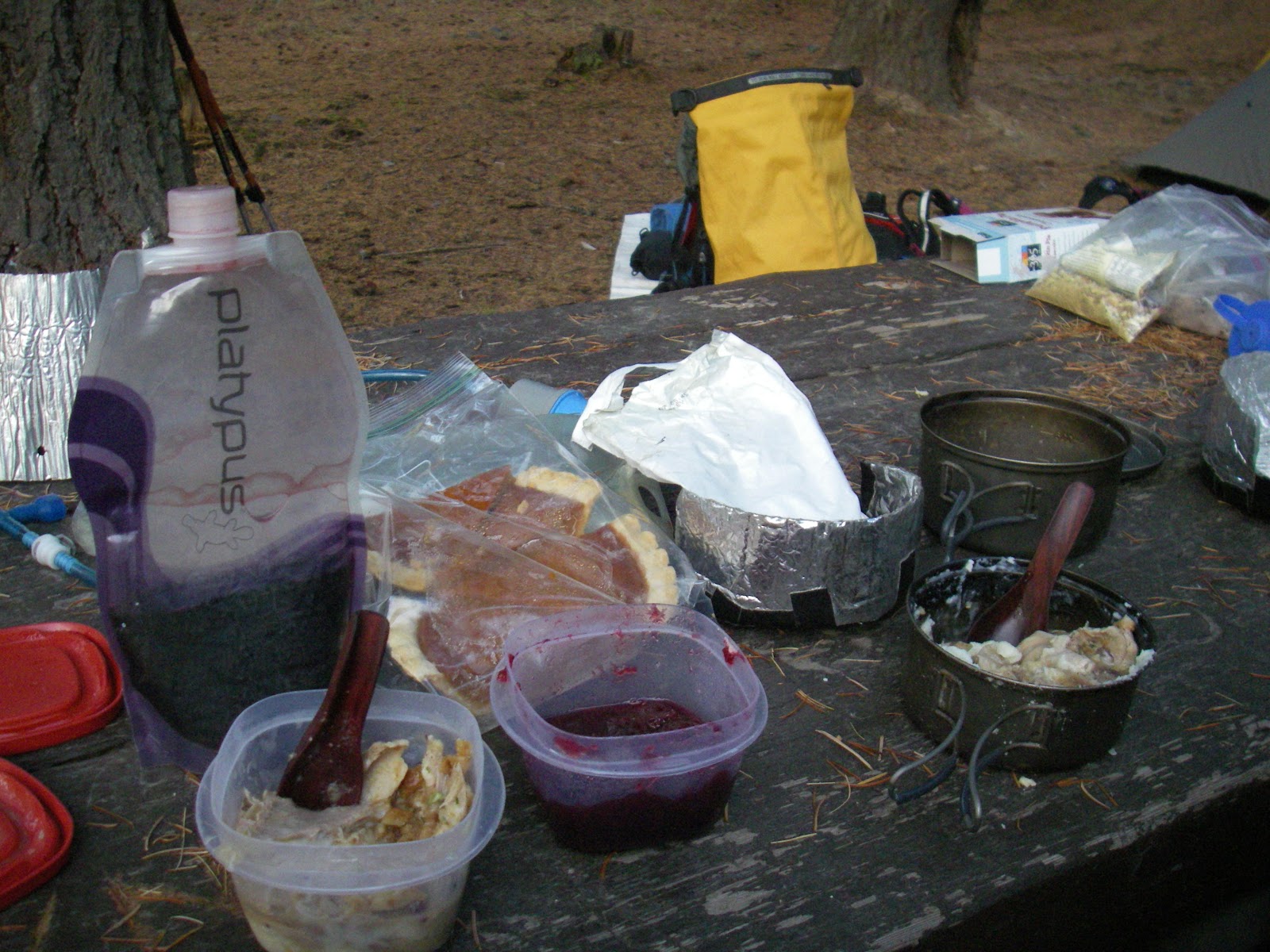
We made camp that night at a vacant campground about 8 miles from the car. The water the whole day had been looking plenty floatable although we had another day of hiking before our boating began. The feast was laid before us and we indulged as we must on this day of days.
Friday began with an overcast sky. We hiked upstream with our still-monstrous packs until we reached the start of the trail...and the water started to look a little low for our boats. Wanting to continue until we found good camping, we bushwhacked off the trail just a mile later when we knew there would be no boating upstream of us, the water was just too low. So we hunkered down early in the afternoon, made a fire on the rocks, played cards and enjoyed our simple day.
 |
| I would not want to be around at flood stage! |
Not long after drifting off to sleep we awoke to rain. Now, I know rain. Northwesterners are no strangers to rain. We were prepared, I had borrowed a pimp'n dry suit from the '80s from my friend Ted, we had warm clothes, our tent and tarp and rain clothes, but rain is still not so welcome on a cold November weekend.
 |
| I feel like a power ranger |
Dodging drops in the morning, we inflated our boats. By the time we put on the water the sky had lightened up a bit, so when we started scraping bottom right off the bat, I was almost working up a sweat trying to navigate the shallow water and avoid rock traps. What we didn't know as we were hiking in was that the water was peaking on Thanksgiving day at about 400cfs. Ideal for packrafting. By the time we put on, the water had dropped to about 200cfs. Not ideal for packrafting.
 |
| floating... |
 |
| And more floating |
Oh, we got along alright. The first mile was the worst, taking about an hour to navigate, but I was proud of the fact that we didn't need to get out of our boats once, but more than once had to lift myself and my boat off a rock.
The rain started, we lunched under the protection of an outhouse before the cold seeping through my body prompted us to hit the river once again. We had orginally been planning on camping about half way from our Friday night camp and the car, but the chill running through my body and the continuous rain made camping at the car sound so much more delightful. Warm clothes, a dry shelter and beer awaited us there, so we continued on.
The floating got better as we went on, but some sections remained plain hairy. The hours got longer and by the time we reached the car just before sunset, realized we had come 12 river miles that day, quite a feat for such low water.
Then Kirk had to go mention that we could conceivably drive home that night. Although we both like to think of ourselves as sturdy outdoors people, not afraid of being cold and wet, when I have a choice I will take comfort! So we belted our PBR, piled in the car and set off.
Now while I like a little suffering now and again, Fall and Winter packrafting takes floating to another level. The added gear and cold factors do not dissuade me from the sport, but it wouldn't be wrong to say I would prefer to ski!
There is just enough snow on our mountains to start venturing out. Maybe we can start experimenting with a ski/packraft trip????
I can see you putting a rudder on that raft and steering your way downhill in the snow. Great post.
ReplyDeleteRenee,
ReplyDeleteI'm going to try and run the NF this spring from the Route 52 bridge/campground to dale. I'm looking for any information you may have on the run. It looks like you hiked that section in 2011. Really anything wold be helpful, how much wood in the river, things to look out for, etc. Thanks, Bob
Hey Bob,
ReplyDeleteI (Kirk) have boated that section a few times, super fun. The section from Route 52 to Granite Creek (15ish miles I think) is very continuous 100 foot per mile gradient. No eddies and many blind corners with lots of wood toward the banks. It is mostly class II with some IIIish stuff. We did not have to portage anything (spring 2010) but every corner was concerning with the amount of trees toward the banks. There was a huge spring flush (spring 2011) that flushed most all of the side lumber to that big log jam you see in the picture above, but be on the look out. That logjam is in a side shoot down low on the run and the main current is in a different channel. At Granite Creek, can`t miss it wood footbridge over the river, the flow doubles so keep this in mind when looking at the gauge read lower on the river. Below the confluence the river has less trees to look out for. The Rapid dirrectly below Granite Creek is rated class V but I feel this is a little exaggerated, yet still easily scoutable/protageable via the trail river right. Look for the footbridge. Shortly below this there is a 200 yard long class III or IV rapid (dependant on flow but closer to class III most of the time) that runs in a straight line, but worth looking at before going down. Below this point the river mellows out quite a bit and gets wider with more flats between small class II and an occasional low class III rapids.
The top part goes by very quickly with not much camping, very brushy banks. There is a big flat field at the confluence with Granite Creek on River Left with multiple camp sites but be wary of the "ticks" they are everywhere!! Last time I was there I counted 18 ticks I had to pull off my legs from just walking across that field, none had dug in yet but there thick. As far as that goes from Granite Creek to about 2 miles downriver they are on every piece of grass just waiting for you to walk by.
Not sure how many days you are going for but on the upper river, (above the dirt road river right), if you see a camp site take it. Not to many river level. There are some horse camps off the trail but seeing them from the river may not happen. Once to the lower part where the dirt road appears on river right there are camp spots everywhere over the last 10-15 miles.
Super good section, surprised more people do not do this trip. I did a half trip one year (time restriction) and hiked out at Granite Creek, and did a bike shuttle. I have, and will at some point, boat Granite Creek and then down to Dale. It appears to be steeper and in the class IV-V range but not sure as it is hidden in the trees.
If you are boating and hiking back to your car there is a good trail all the way, but if using a shuttle there is a (so I`ve been told) guy who does shuttles in Dale. Small town ask around or call ahead to the store they might know. Check and see if road #10 is open and clear of snow before you go or the shuttle is going to triple in size.
Let me know if anything is not clear or any other info I can pass along.
Kirk
correction: where I wrote " I have, and will at some point, boat Granite Creek and then down to Dale" should have said "I want to, and will at some point, boat Granite Creek and then down to Dale"" not "I have".
DeleteCannot correct once it gets posted.
Kirk, That is awesome information. I really appreciate it. A buddy and I are planning on doing it in May in IK's. Any recommendations on flow? We were thinking about 1,000-2,000 range on the Monument scale. I have done the lower section from end of the dirt road down and always wanted to tackle the upper.
DeleteAnother one that's fun when the water is running good is Camas Creek along the highway 395. From the pictures of the upper NF I think they are pretty similar.
Thanks for the info, I was beginning to think no one has run this section. I even tried contacting "Soggy Sneakers" for more first hand info with no response.
-Bob
Hey Bob,
DeleteIn regards to the flow, levels 1000-2000 sounds like a good level. The times I have done it was in that range, (1800 - 2200 I think). I always tell myself that I need to keep a river journal in relation to flows and conditions to remember things like that but sadly just does not seem to happen. I have not done Camas Creek but always looked interesting. I talked to Jim (soggy sneakers) a long time ago and some of the info they have in there old book, not sure if this run is in the new edition, was second or third hand information. They tried to get rid of some of these descriptions in the newer editions unless they could find someone who wanted to write a description who had actually done the river. Have Fun out there!
Kirk